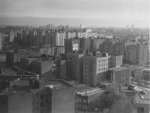
If you have a photograph that captures some recognizable block or neighborhood or landmark in the Bronx,
we would love to add it to our gallery. Here are details on submitting your pictures.
Click on the small photo
for a larger version | |
 |
This picture, taken in 1961, shows the construction of the I-95
bridge over the Harlem River which would connect the Cross Bronx
Expressway to the George Washington Bridge approach. Notice that
the Washington Heights apartment towers that would later
straddle the highway had not yet been built. The old Washington
Bridge is just north of the construction site.
--Marshall Fishman, from the Collection of Philip Fishman
|
 |
Taken in 1954, this is a view of 167th Street where it crosses
Ogden Avenue and rises eastward past Nelson Avenue. According to
my father, the triangular, wooden building at the bottom of the
picture was originally built before Lincoln was president.
--Marshall Fishman, from the Collection of Philip Fishman
|
 |
This 1956 photo is a view of University Heights facing
northeast. At the bottom right is Ogden Avenue. The white brick
cluster of buildings just left of center were the Noonan Plaza
Apartments. At the far left you can see part of P.S. 11, and I
believe that the white building at the horizon in the middle was
Lebanon Hospital on Mt. Eden Avenue and the Grand Concourse.
--Marshall Fishman, from the Collection of Philip Fishman
|
 |
Looking southeast from our apartment in Highbridge Houses in
1956, you are looking at the back of the Crest Theater on Ogden
Avenue. On the other side of Ogden was a vacant lot, and to the
right of the theater was a commercial building.
--Marshall Fishman, from the Collection of Philip Fishman
|
 |
Eight years later, in 1964, you can see the construction of a
new A&P Supermarket on Ogden Avenue where the vacant lot had
been. The commercial building to the right of the Crest is in
ruins. In the far background at the top right, you can see the
twin towers of the Concourse Plaza Hotel on 161st Street and the
Grand Concourse.
--Marshall Fishman, from the Collection of Philip Fishman
|
 |
Here is a progression of pictures, beginning in 1954 and ending
in 1964, that shows the construction of the Major Deegan Expressway.
1954: Early construction used barges and the New York Central
railroad (which would later become the Hudson Line of Metro
North) to transport materials for the highway. The rail
equipment at the far right were Madison Passenger and Baggage
cars. Construction office trailers stand where the actual
roadway would later be built. In the background is Highbridge,
still open for foot traffic, spanning the Harlem River and the
Harlem River Drive, and terminating at Highbridge Tower, which
rose above Highbridge Pool.
--Marshall Fishman, from the Collection of Philip Fishman
|
 |
1955: Most of the construction offices have been removed and the
road bed is wider, with piles of stones still to be removed
before paving could begin.
--Marshall Fishman, from the Collection of Philip Fishman
|
 |
1962: Completed and heavily used by this time, the Deegan
quickly became an indispensible route from the Bronx to "the
country." North of the Bronx it became the New York Thruway, and
endless Bronxites could now easily find their way to summer
escapes in bungelow colonies in the Catskills.
--Marshall Fishman, from the Collection of Philip Fishman
|
 |
1963: To the right of Highbridge Tower, you can see that
construction of the Washington Heights towers, being built
directly above the I-95 approach to the George Washington
Bridge, was about halfway completed. At the bottom is the access
road from Sedgwick Avenue into the University Heights apartments
complex.
--Marshall Fishman, from the Collection of Philip Fishman
|
 |
1964: The Washington Heights towers are completed, and they
provide a sharp contrast to the gothic architecture of the
Highbridge Tower. Below, the New York Central right-of-way has
been narrowed to only two tracks.
--Marshall Fishman, from the Collection of Philip Fishman
|

